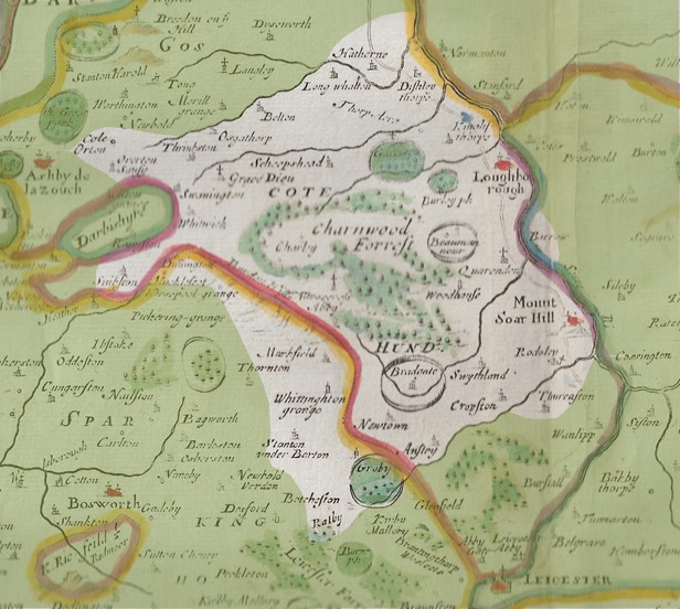
Over 600 volunteers took part in out Charnwood Roots research project. They collected over 6,000 pieces of information about the places being researched (the unshaded area in the map above), and uploaded them into a project databank.
You are free to use this data as you wish, but if you include it within any electronic or paper publication, website or display, please acknowledge its source as LVCHT Charnwood Roots Databank and provide a link to the relevant page. We are not aware that any of the images or other items in this databank breach copyright, data protection or any other regulations, but please contact us if you consider your rights have been infringed.
If you’re wondering about the map above, it is from Robert Morden’s map of Leicestershire, c.1722.
ENTER THE DATABANK
We thank the Heritage Lottery Fund and the University of Leicester for their support.